SWAT and SWAT+
February 2023
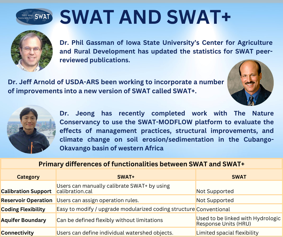
Dr. Phil Gassman of Iowa State University’s Center for Agriculture and Rural Development has updated the statistics for SWAT peer-reviewed publications. The SWAT literature database now includes 5,580 publications since 2000, and it is currently increasing at a rate of over one publication per day!
Dr. Jeff Arnold of USDA-ARS been working to incorporate a number of improvements into a new version of SWAT called SWAT+. Among other improvements:
- SWAT+ has spatial objects (hydrologic response units, channels, ponds, reservoirs, aquifers, etc.) that can link with other objects, including surface runoff, tile flow, lateral flow and percolation. This allows SWAT+ to delineate flood plains from uplands, route flow directly from fields to streams or wetlands, simulate reservoirs in series, and model other watershed configurations not possible in SWAT.
- SWAT+ uses decision tables for land management and reservoir releases. Management operations and land use changes can be scheduled based on numerous variables, including time, climate, soil and plant status, reservoir volumes, etc.
- SWAT+ has built-in routines for calibrating input parameters for crop yields and water balance.
- A gridded groundwater model has been built into the SWAT+ code. This allows simulation of individual groundwater wells and the interactions of aquifers with streamflow, reservoir levels, etc.
- A complete salt transport model simulating 8 different ions is included in SWAT+. Fate and transport of salts, as well as their impacts on plant growth, are simulated.
- SWAT+ has new routines for water allocation. Water can be transferred from multiple sources (including channels, reservoirs and aquifers), to multiple uses (including irrigation, municipal drinking water, and inter-basin transfers).
Dr. Jeong has recently completed work with The Nature Conservancy to use the SWAT-MODFLOW platform to evaluate the effects of management practices, structural improvements, and climate change on soil erosion/sedimentation in the Cubango-Okavango basin of western Africa. The basin provides water and sediment to the Okavango Delta, a 2-million-hectare UNESCO World Heritage site.