Reducing flood risk in Central Texas
Background
In 2015 and 2016, devastating flooding across Texas resulted in significant loss of life, infrastructure damage, and economic impacts which severely affected Coryell and surrounding counties in the Leon River Watershed. These back-to-back events qualified the area for federal disaster recovery funding which is administered by the Texas General Land Office (GLO). In November 2024, AgriLife signed a $3.9M contract with the Texas GLO to support the development of surface flow models for real-time flash flood warning and the implementation of mitigation projects to reduce flood risk the Leon River Watershed.
The project involves partnerships among Texas A&M AgriLife Research, the American Conservation Foundation, RRG Professional Engineering, and the Texas A&M Institute for Science, Technology, and Public Policy. Multiple objectives include developing flood management plans, installing flood gauges, building flood flow models, and investigating future flooding potential and water supply conditions.
Goal and Objectives
The project goal is to reduce flood-related risks in the LRW, CCW, and downstream communities while also improving future water security and supply. Objectives toward this goal include:
- Develop and apply Leon River Watershed hydrologic/hydraulic – surface/ groundwater flow models for real-time flood warning and future planning.
- Develop and implement a flood-risk reduction program by improving flood management and response, installing a flood early-warning system, and fostering flood and high-water safety education in project-area communities.
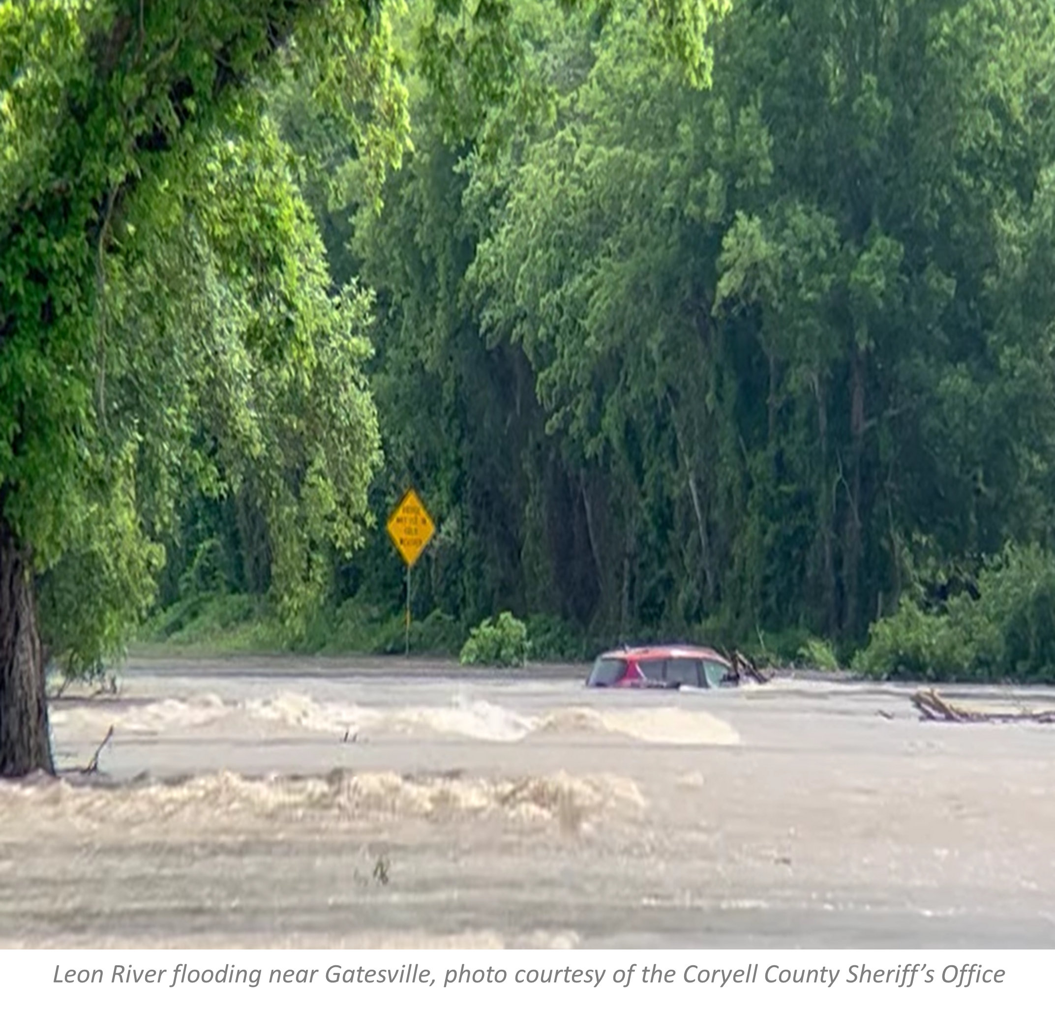
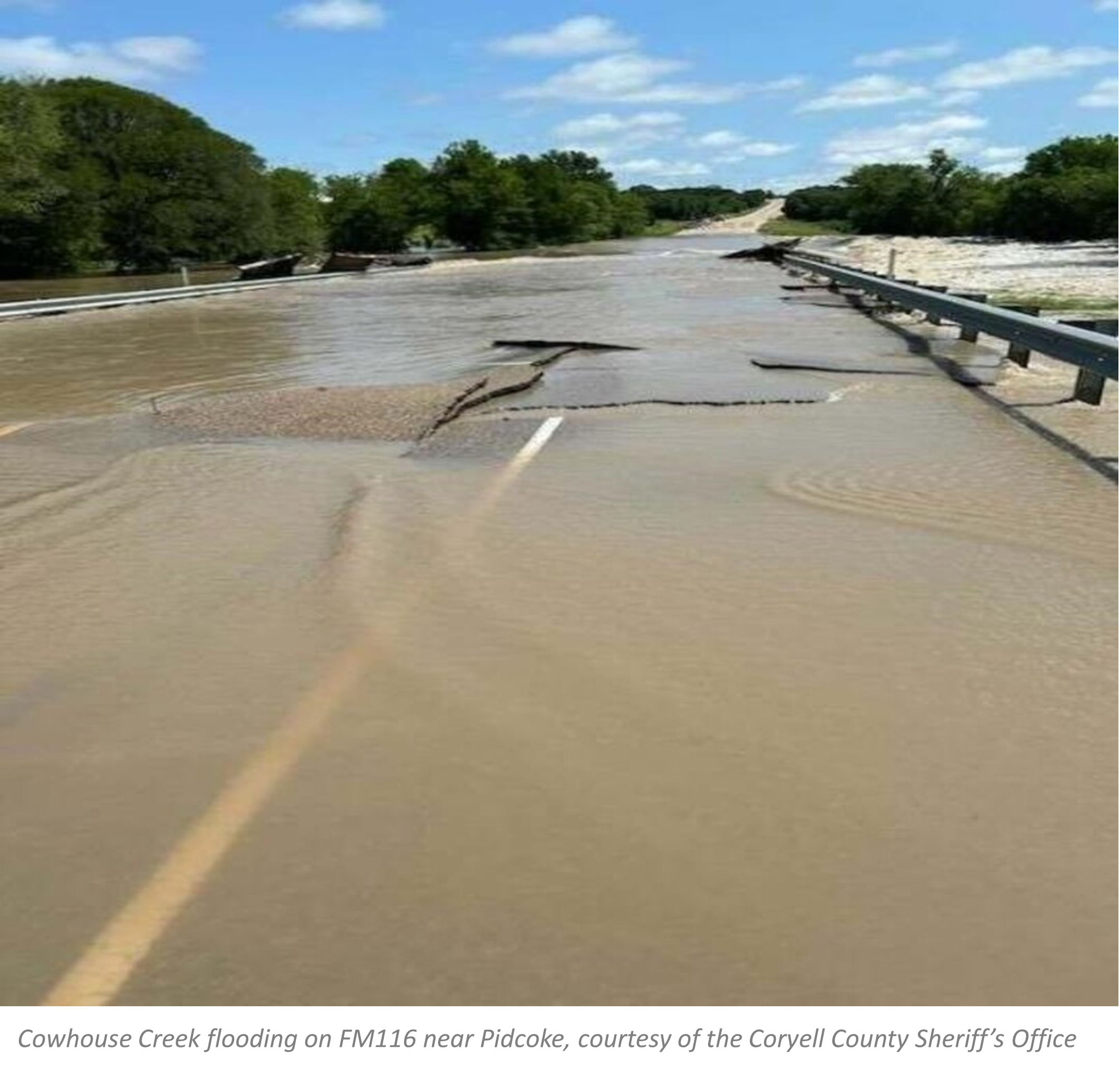
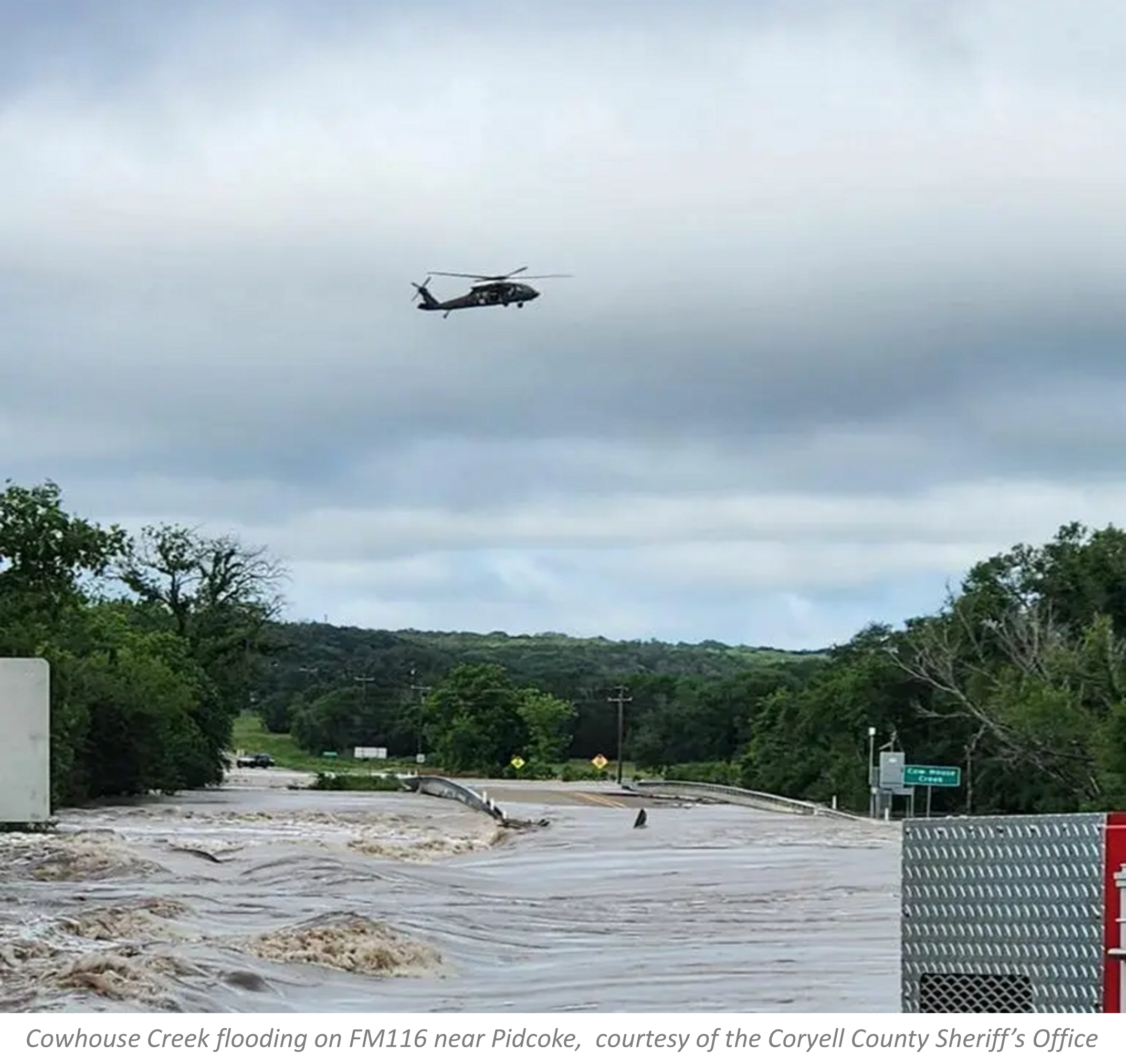
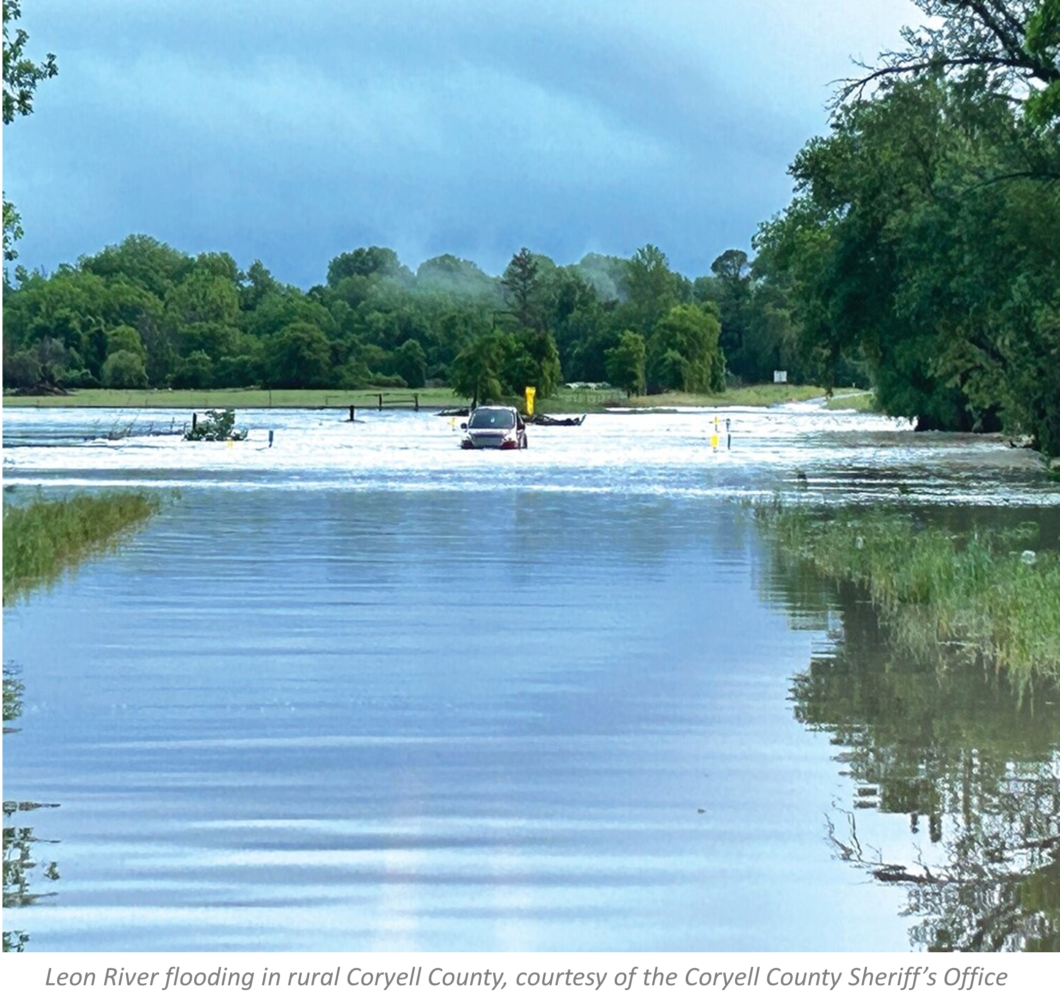
Credit: Flooding photos courtesy of the Coryell County Sheriff’s Office
Description
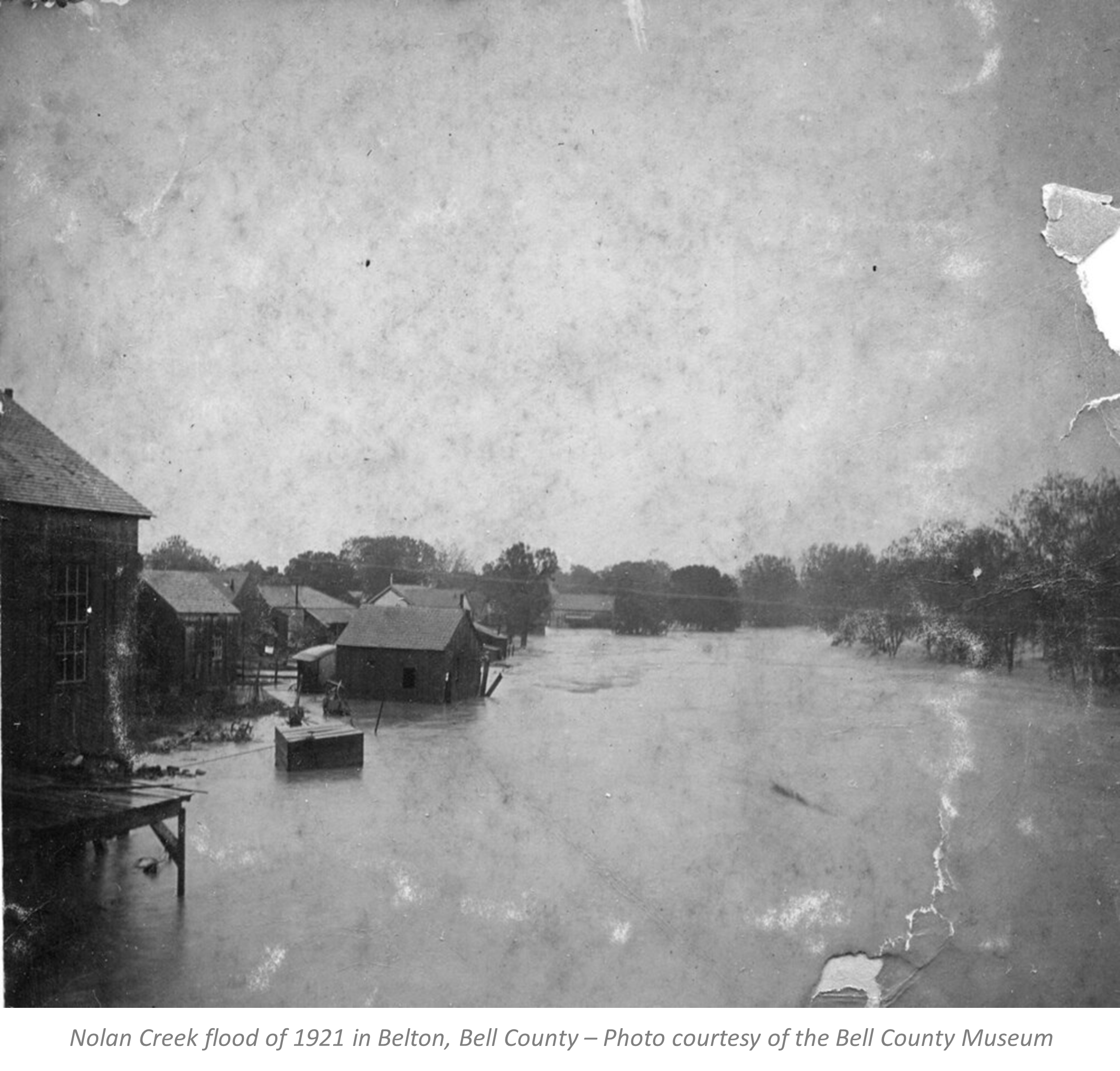
Rural communities in the upper and middle Leon River and Cowhouse Creek Watersheds are subject to significant flood-related risk when stormwater runoff events cause short-term flash floods and long-term riverine floods that disrupt agricultural activities, destroy crops, threaten livestock, damage infrastructure, and cause financial losses for farmers and ranchers in the area. Downstream urban communities in Coryell and Bell Counties are at increased flood-related risk due to population growth and land use change. Fort Hood in particular has a long and painful history of property damage and loss of life associated with flash flooding.
Flood events represent complex hydrometeorological and sociological problems which encompass both technical and human behavior challenges. Although flooding cannot be prevented, the development of accurate and robust flood flow models, combined with Flood Early Warning Systems (FEWS), high-water safety awareness education programs, and flood management planning can help meet the goal of reducing flood-related risks.
As the State of Texas grapples with increasing water shortages due to drought conditions and a growing population, it must adopt water management strategies that combine scientific insight, engineering solutions, and stakeholder involvement to develop plans that not only mitigate high-water risks but also consider flood flows as potential water sources to bolster dwindling supplies.
The Leon River Watershed (LRW) encompasses approximately 3021 square miles in central Texas falling predominately in Eastland, Comanche, Hamilton, Coryell, and
Bell Counties with smaller portions falling in Mills, Brown, Calahan, Stephens, and McLennan Counties. The Cowhouse Creek Watershed is a sub-watershed of the LRW and encompasses some 727 square miles spanning 4 counties including Mills, Hamilton, Coryell and Bell. The Leon River and Cowhouse Creek main channels merge at Lake Belton. This project covers the LRW area to the point where its drainage converges with the Lampasas River and forms the Little River in East Bell County.

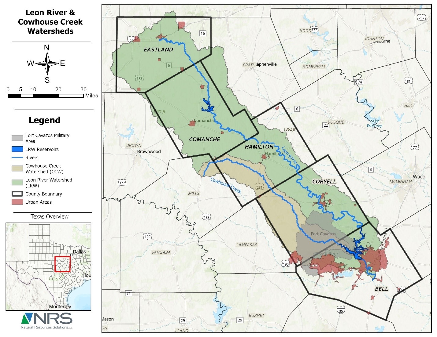
Project area: Leon River Watershed and Cowhouse Creek Watershed
Texas A&M AgriLife Research signed the project contract with the Texas General Land Office in November 2024. Subcontractors under AgriLife include the American Conservation Foundation, The Institute for Science, Technology, and Public Policy, and RRG Professional Engineering. The project is scheduled to be completed in May 2027 (30 months).
Texas A&M AgriLife Research - is the project’s lead and coordinates activities among the multiple project participants. AgriLife Research is also responsible for the development, calibration and implementation of surface-water flow models (SFM) for flood prediction, warning, and future risk. The SMF uses a coupled hydrologic-hydrologic design based on the Soil and Water Analysis Tool (SWAT) and the U.S. Army Corps of Engineers Hydrologic Engineering Center's River Analysis System (HEC-RAS). This coupled model design is expected to help understand, predict, and optimize mitigation strategies for flood-related flows in the project area.
The American Conservation Foundation (ACF) – is a Texas-based non-profit that strives to conserve native ecosystems by incentivizing private landowner participation. ACF is engaging stakeholders in the Leon River Watershed to develop locally focused flood management plans.
The effort includes assessments of historic and existing flood-related management procedures and responses, recommended actions to improve the current flood alert system operation, data analysis and interpretation, development of emergency action plans, and improvement of coordination among responsible entities managing flood-related activities. ACF is following general guidelines provided in the Texas Water Development Board’s Flood Emergency Warning Systems (FEWS) Guidance Document.
The Institute for Science, Technology, and Public Policy (ISTPP) at the Texas A&M University Bush School of Government and Public Service fills the gap between science and technology research and public policy research. ISTPP is working to establish an integrated and collaborative policy framework for evaluating and investing in flood risk reduction and security and for water resources stressed by multiple usage demands and overseen by complex governance systems. Using stakeholder and public engagement tools, ISTPP is identifying the extent and scope of key problems and solutions that project stakeholders and the public must consider as they weigh specific costs and benefits.
RRG Professional Engineering – is a private water research and consulting firm that provides engineering services related to water resources management, hydrology, and hydrogeology. RRGPE is examining Leon River Watershed groundwater flows in the context of flooding using the US Geological Survey’s Modular Finite-Difference Groundwater Flow Model (MODFLOW). Groundwater conditions influence flood dynamics by increasing runoff when saturated and decreasing runoff when unsaturated. Working with AgriLife surface flow modelers, RRGPE is linking SWAT/HEC-RAS output to improve surface flow estimates. RRGPE is also investigating a limited number of localized groundwater scenarios considering managed aquifer recharge.
Texas A&M AgriLife Research – Blackland Research and Extension Center - project lead and surface water modeling
Dr. June Wolfe – Texas A&M AgriLife Research, Research Scientist, Project Coordinator
Dr. Arun Bawa – Texas A&M AgriLife Research, Assistant Professor, Surface water modeling
American Conservation Foundation (Natural Resource Solutions) – Flood mitigation
Mr. David Jones – Flood mitigation and planning
Institute for Science, Technology, and Public Policy at Texas A&M University The Bush School of Government and Public Service - Public policy assessment and development
Ms. Carol Goldsmith – Flood policy assessment and development
RRG Professional Engineering – Water research and consulting
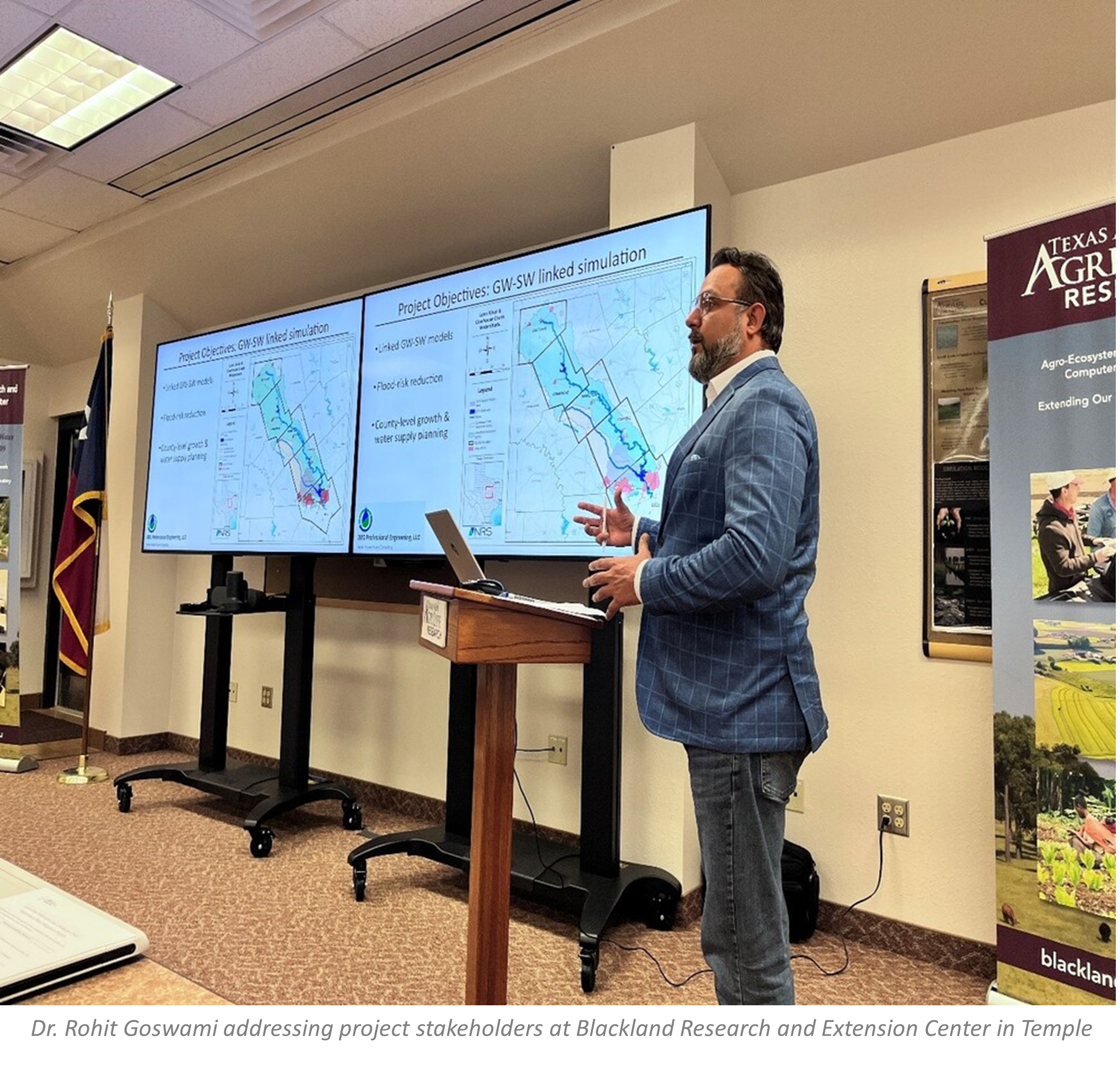
Dr. Rohit Goswami – Hydraulic Engineer, Groundwater modeling
Texas General Land Office (GLO)

Texas Water Development Board