Models / APEX: Agricultural Policy / Environmental eXtender

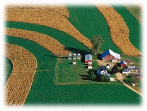
APEX, Agricultural Policy/Environmental eXtender model, was developed to extend EPIC’s capabilities of simulating management and land use impacts for whole farms and small watersheds. EPIC (Environmental Policy Integrated Climate model) is a cropping systems model that was developed to estimate soil productivity as affected by erosion. APEX was constructed to evaluate various land management strategies considering sustainability, erosion (wind, sheet, and channel), economics, water supply and quality, soil quality, plant competition, weather, and pests.
For more information, please visit https://epicapex.tamu.edu/about/apex/ .
Capabilities
APEX functions on a daily time step and can simulate hundreds of years for approximately one hundred different crops. It can be configured for land management strategies such as irrigation, drainage, furrow diking, buffer strips, terraces, waterways, fertilization, manure management, lagoons, reservoirs, crop rotation and selection, pesticide application, grazing, and tillage. The routing of water, sediment, nutrient, and pesticide capabilities are some of the most comprehensive available in current landscape-scale models and can be simulated between subareas and channel systems within the model.
Various APEX Applications:
APEX can perform long-term continuous simulations for modeling the impacts of different nutrient management practices, tillage operations, conservation practices, alternative cropping systems, and other management practices on surface runoff and losses of sediment, nutrients, and other pollutant indicators. Example applications include:
- evaluate effects of global climate and carbon dioxide changes on crop yields
- assess alternative manure applications and other management scenarios
- design biomass production for energy
- demonstrate hydrologic balance components and pollutant transport for different cropping and forestry production systems
- simulate intensive rotational grazing scenarios depicting movement of livestock between paddocks
- evaluate the effects of different tree harvesting treatments on forested watersheds
- analyze the potential benefits of “woody draws” (relatively small, natural drainage areas covered by trees or shrubs in agricultural landscapes)
- determine cropping and conservation practice effects on lake systems
- simulate landscape management decisions such as harvest unit size, total area harvested, and rotation length
- assess environmental impact of pollutants into lakes
- evaluate effects of buffer strips
- simulate nonpoint-source pollution impacts from cultivated cropland
- design economical and environmentally safe landfill sites
Model Interfaces
- WinAPEX
- ArcAPEX
Support Team
Jimmy R. Williams, Ph.D.Senior Research Scientist(254) 774-6124 Avery MeinardusProgrammer I(254) 774-6110 Evelyn Steglich, M.S.Senior Research Associate(254) 774-6127 DownloadsAPEX Theoretical Documentation The theorectical documentation provides detailed description of the APEX Model beginning with the subarea component followed by routing, reservoir, groundwater, grazing, manure management, and feedlot dust emission and distribution components. The components are fully described because the model has been revised and expanded beyond the latest report.
APEX User’s Manual: User’s guide for APEX v.0604
The Agricultural Policy Environmental EXtender (APEX) Model: An Emerging Tool for Landscape and Watershed Environmental Analyses (technical report)
The Agricultural Policy Environmental EXtender (APEX) Model: An Emerging Tool for Landscape and Watershed Environmental Analyses (ASABE published paper)
